By connecting spaces, infrastructure, mobility, and environment — our RAKAZ IoT platform and ELMNTX-LYT Edge deliver real-time intelligence across Water, Energy, Air, and City operations.
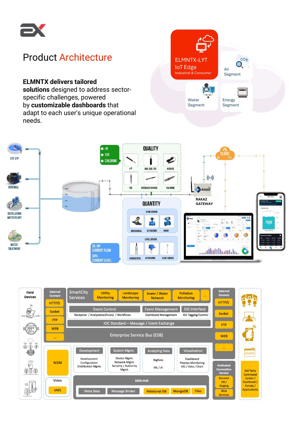
A unified platform connecting field devices to cloud intelligence across Water, Energy, and Air segments — with sector-specific dashboards adapting to each operational need.
Water management, smart irrigation, pumpstation monitoring — quality (pH, TDS, Chlorine) and quantity (flow, level) in one platform.
Street lighting automation, building energy management, HVAC optimization — up to 40% energy saving and CO₂ reduction.
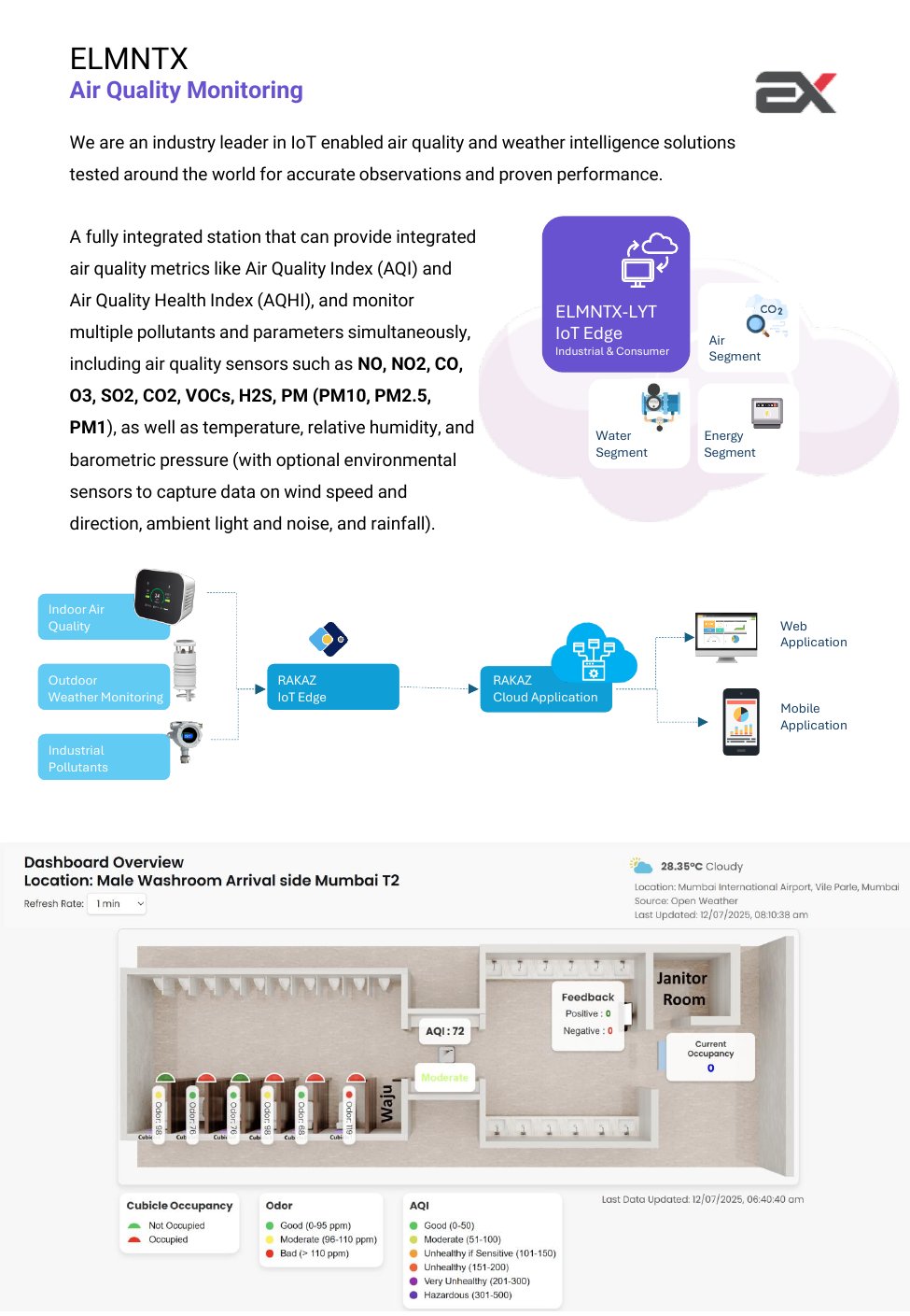
Indoor IAQ, outdoor weather monitoring, industrial pollutant detection — AQI, AQHI, NO2, CO, O3, SO2, CO2, VOCs, PM2.5, PM10.
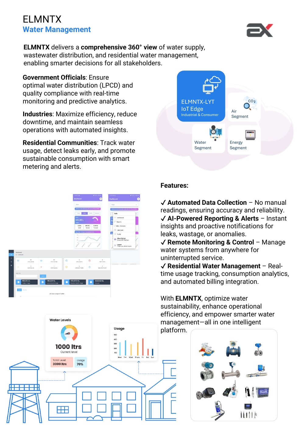
360° view of water supply, wastewater distribution, and residential water management. Automated data collection, AI-powered alerts, remote monitoring and automated billing integration.
Industry-leading IoT-enabled AQI and weather intelligence. Monitors NO, NO2, CO, O3, SO2, CO2, VOCs, H2S, PM10, PM2.5, PM1, temperature, humidity, barometric pressure, wind speed and rainfall.
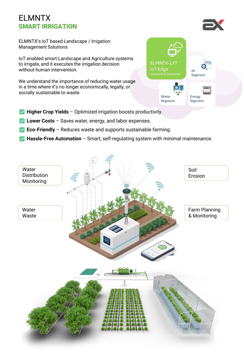
IoT-enabled smart landscape and agriculture — executes irrigation decisions without human intervention. Higher crop yields, lower costs, eco-friendly, hassle-free automation with minimal maintenance.
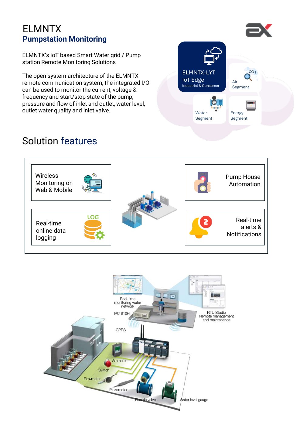
Smart water grid remote monitoring — current, voltage, frequency, pump start/stop, pressure, flow, water level, outlet quality, and inlet valve — wireless on web and mobile with real-time alerts.
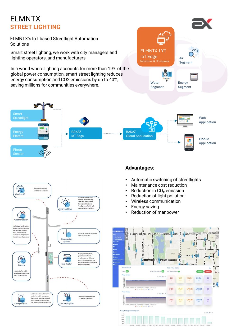
IoT streetlight automation reducing energy consumption and CO₂ emissions by up to 40%. Automatic switching, wireless communication, energy saving, maintenance cost reduction and manpower reduction.
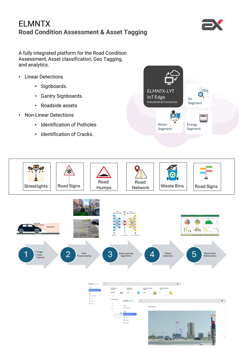
AI-powered road inspection with windshield-mounted cameras — deep learning detects potholes, cracks, signboards, gantry signs, road humps, waste bins, and road network assets with geo-tagging.
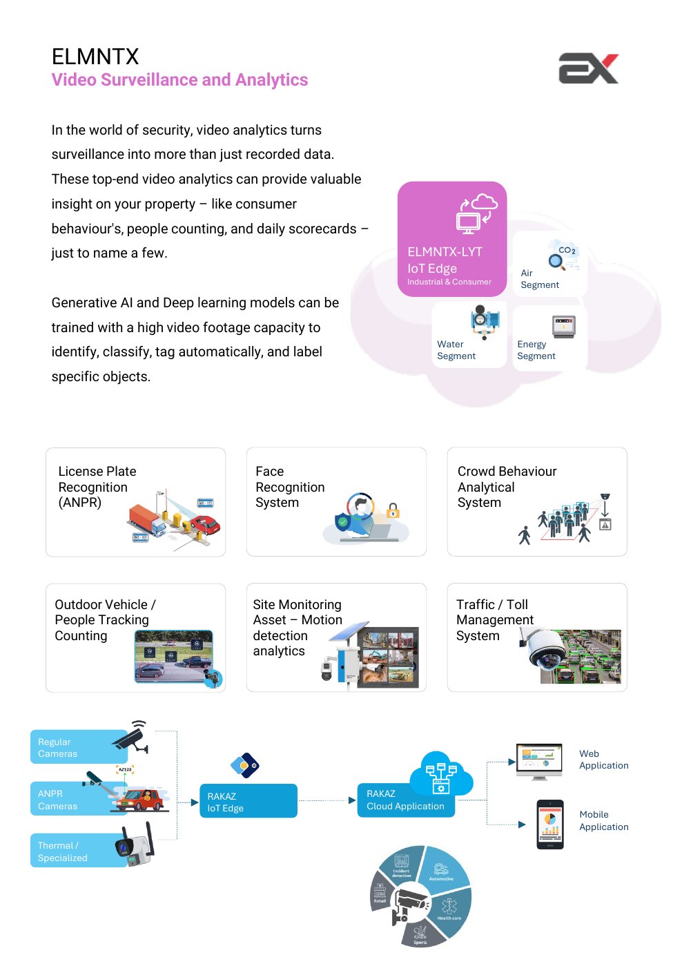
Generative AI and deep learning for ANPR, face recognition, crowd behaviour analysis, people counting, vehicle tracking, site monitoring, and traffic/toll management.
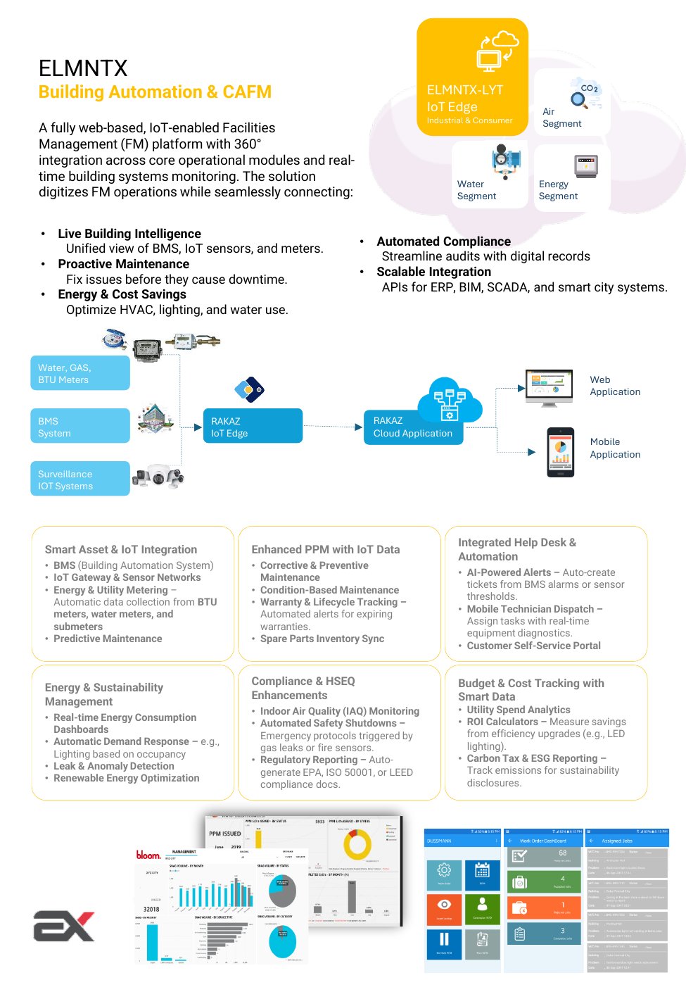
IoT-enabled FM platform with 360° integration — BMS, IoT sensors, PPM, corrective/preventive maintenance, energy dashboards, IAQ monitoring, automated compliance, and budget tracking.
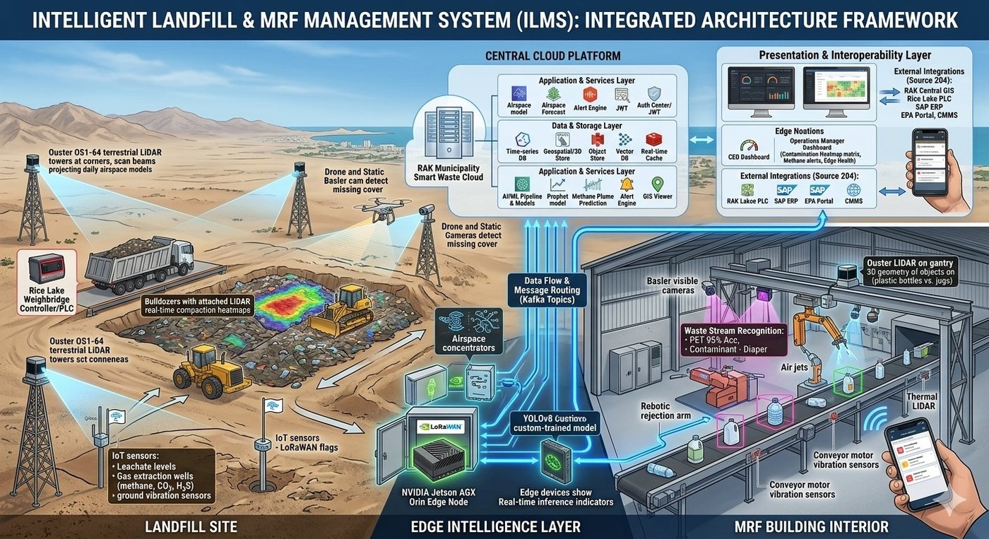
ILMS — AI-powered Landfill and Materials Recovery Facility management. LiDAR 3D airspace mapping, YOLOv8 waste sorting at 95% accuracy, IoT methane/leachate sensors, and automated EPA reporting.
From reactive disposal to predictive operations — ILMS unifies LiDAR mapping, AI waste sorting, IoT sensors, and automated EPA compliance into a single cloud-native command centre.
Ouster OS1-64 terrestrial LiDAR towers with bulldozer-mounted units — remaining airspace calculation at ±2% accuracy. Daily 3D compaction heatmaps, drone + static Basler camera cover detection. Geospatial / 3D object store with vector DB.
YOLOv8 custom-trained model on NVIDIA Jetson AGX Orin edge node — 12+ waste categories at 95% accuracy. PET 95% detection, contamination flagging (diapers, contaminants), robotic rejection arm control via air jets. Ouster LiDAR gantry for 3D geometry of objects.
LoRaWAN IoT flags for leachate levels, gas extraction wells (methane CH₄, CO₂, H₂S), and ground vibration sensors. Conveyor motor vibration sensors with predictive maintenance AI. Kafka Topics for data flow and message routing. XGBoost for equipment failure prediction 5–7 days before event.
LSTM-based methane plume prediction model in the cloud AI/ML pipeline. Digital ticketing with automated operations manager dashboard (contamination heatmap, methane alerts, edge health). One-click automated EPA regulatory reporting. Integrates with SAP ERP, RAK Central GIS, Rice Lake PLC, and CMMS.
India & Nigeria · Municipal Waste Operations
Deployments in India & Nigeria — Waste Management Departments reduced OPEX by $620k annually. Landfill life extended by 18 months. Full ROI achieved in 11 months. Integrated with local EPA portals for automated regulatory compliance.
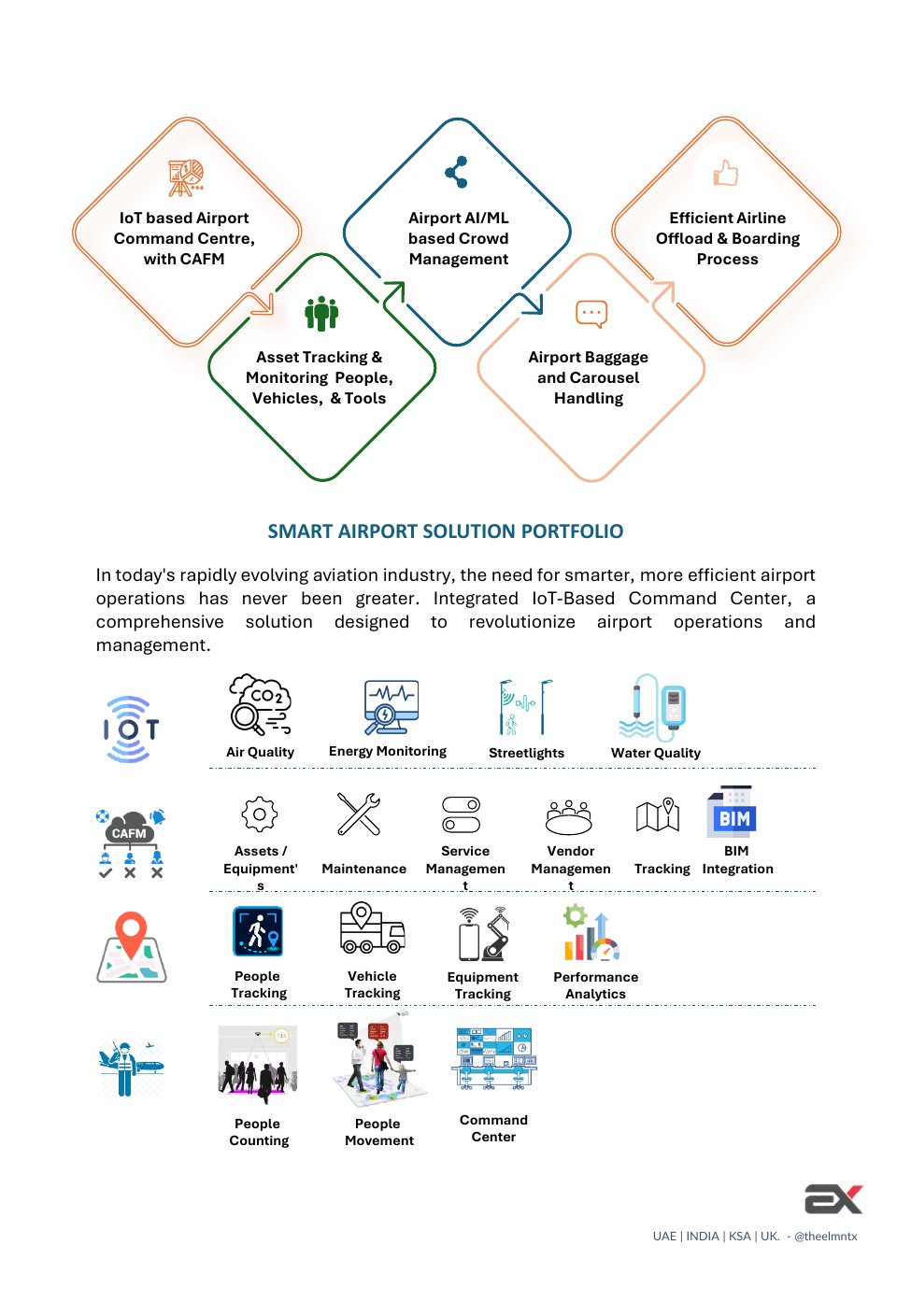
A comprehensive solution revolutionizing airport operations — integrating IoT Command Centre with CAFM, AI-powered crowd management, and real-time asset tracking.
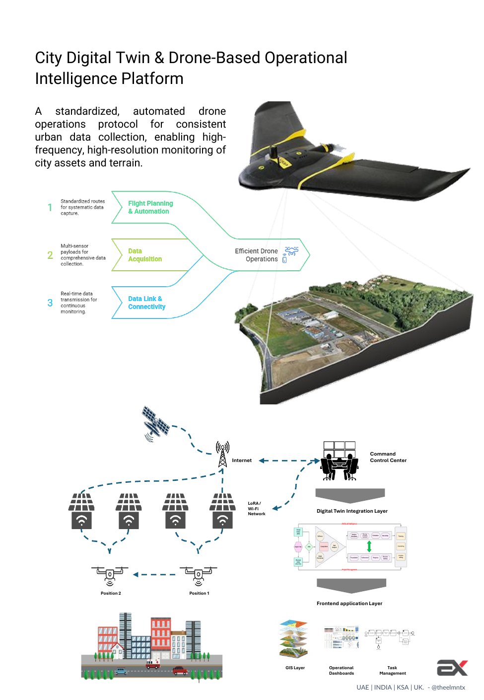
A standardized, automated drone operations protocol for consistent urban data collection — high-frequency, high-resolution monitoring of city assets and terrain.
Standardized routes for systematic data capture — multi-sensor payloads for comprehensive collection across city zones.
Multi-sensor payloads for comprehensive data collection with real-time transmission for continuous monitoring.
GIS Layer, Operational Dashboards, Task Management, and Frontend application layer — complete command center integration.
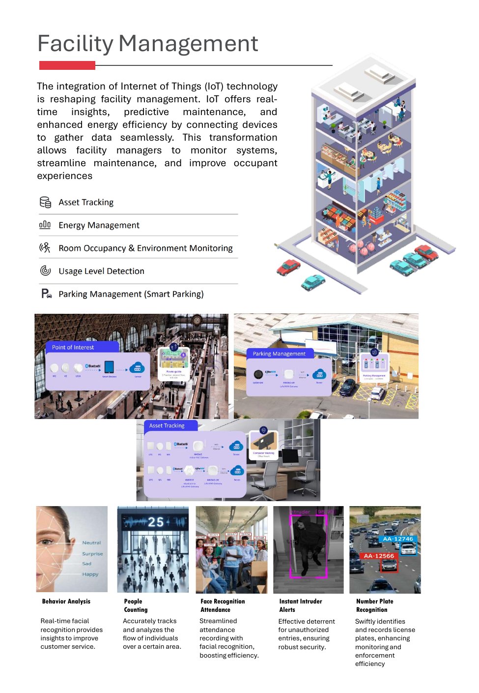
Real-time insights, predictive maintenance, and enhanced energy efficiency — connecting devices to gather data seamlessly across every building system.
BLE/LoRaWAN-based real-time asset location and condition monitoring across all facility zones.
Real-time consumption dashboards, automatic demand response, leak detection, and renewable optimization.
Environmental monitoring with AQI, occupancy sensors, and automated HVAC/lighting controls.
Real-time parking availability, guidance, and revenue management with LiDAR and camera integration.
Real-time facial recognition providing insights to improve customer service and security response.
Swiftly identifies and records license plates — enhancing monitoring and enforcement efficiency.
Talk to our RAKAZ platform experts about connecting your infrastructure to real-time intelligence.